This is the brand new personal website of ....Casper ter Kuile.... in preparation |
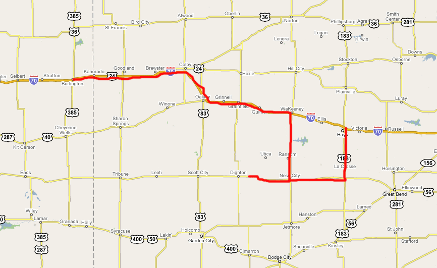
- Chasing to the best of US severe weather: from Burlington in Colorado to Colby, WaKeeney and Ness City to Hays in Kansas
from Burlington (Colorado) via Colby, WaKeeney, Ness City to Hays (Kansas)- Some images of our very succesfull stormchase to Ness City in Kansas
- SPC Convective Outlook for 22 may 2008
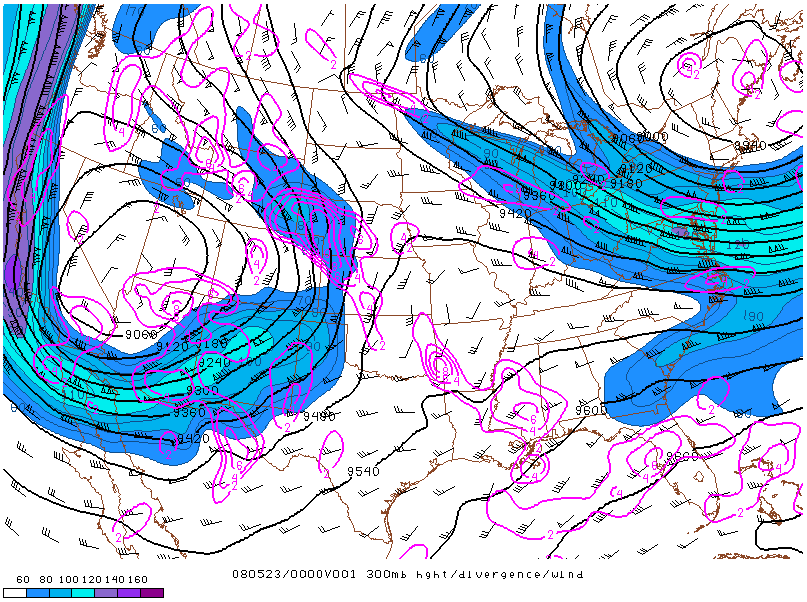
- Location of the jet on 23 may 2008 at 00:00 UTC
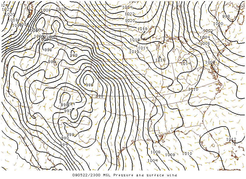
- MSL Pressure and Surface Wind on 22 may 2008 at 23:00 UTC
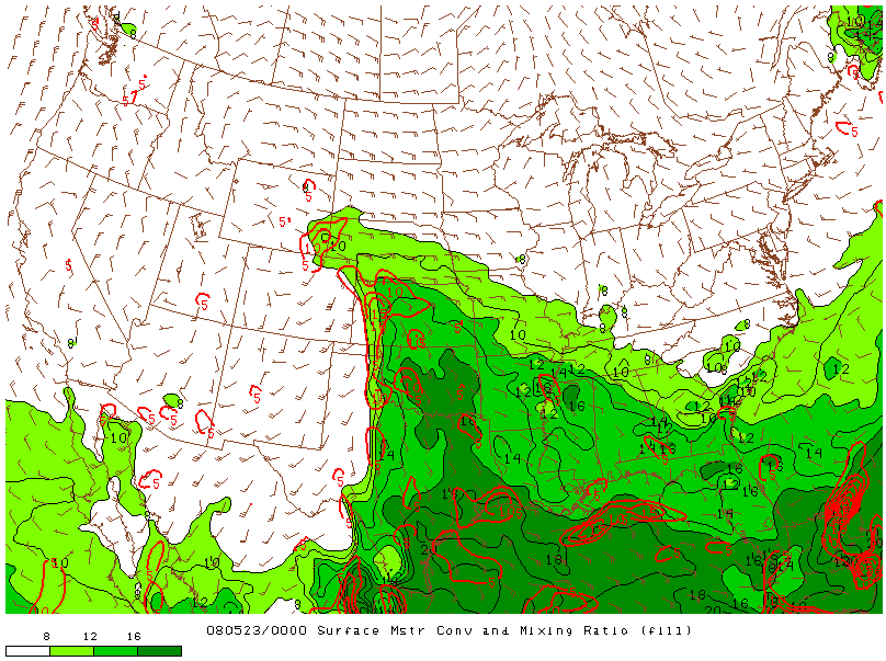
- Surface Moisture and Mixing Ratio on 23 may 2008 at 00:00 UTC
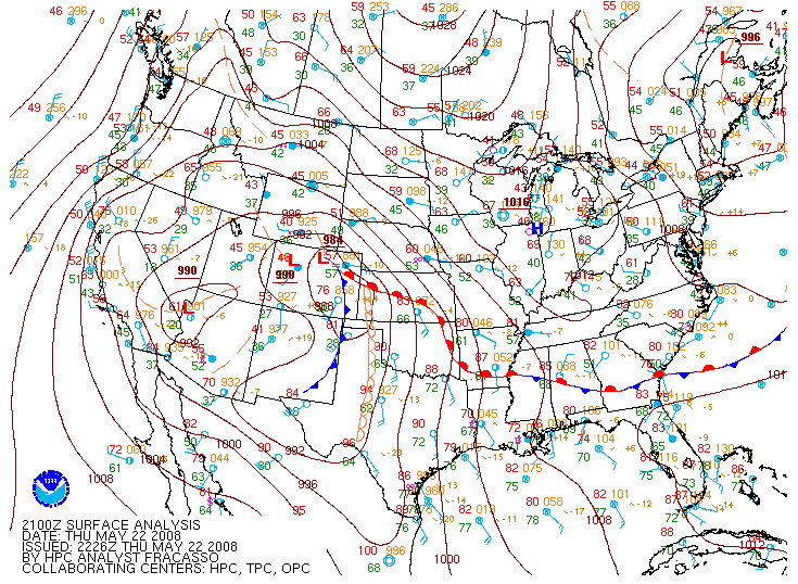
- Surface Map on 22 may 2008 at 21:00 UTC
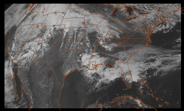
- GOES Visible image on 22 may 2008 at 20:32 UTC
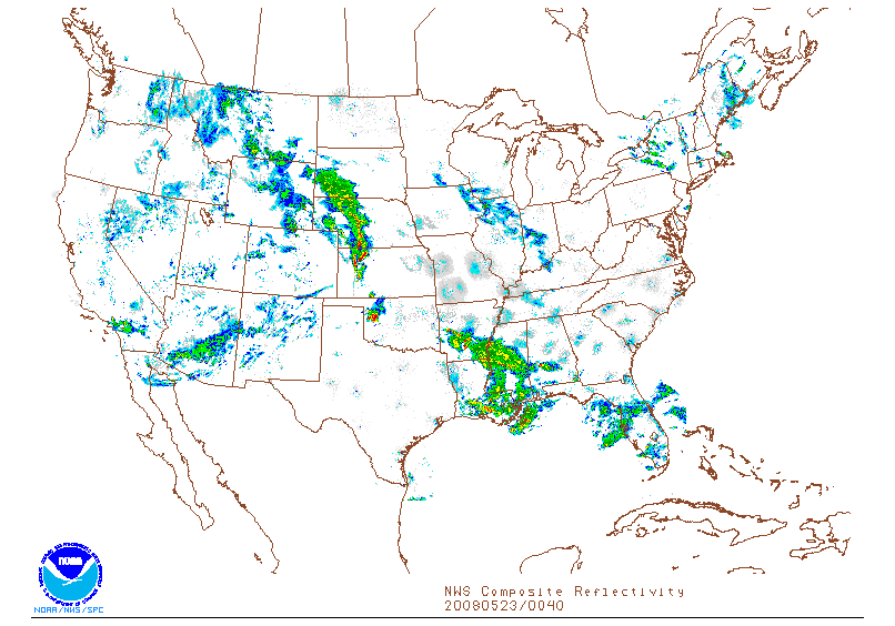
- NWS Composite Reflectivity on 23 may 2008 at 00:40 UTC
- SPC Storm Reports of 22 may 2008
- Archive of the Severe Thunderstorm Event: May 22, 2008
Chasing to the best of US severe weather: from Burlington in Colorado to Colby, WaKeeney and Ness City to Hays in Kansas
Today is the great day. The forecast is a MDT which means really severe weather might develop this afternoon. We are now in Burlington, eastern Colorado and will move eastwards into Kansas to WaKeeney. There we will investigate the situation again for finetuning. Lots more later....Map: from Burlington in Colorado to Colby, WaKeeney and Ness City to Hays in Kansas
Back in Hays after a very succesful chase. Later more bacause we gonna have some sleep now.
Stormchase 22 may from Burlington > Colby > Wakeeney > Ness City > Hays
Location of the jet on 23 may 2008 at 00:00 UTC
MSL Pressure and Surface Wind on 22 may 2008 at 23:00 UTC
Surface Moisture and Mixing Ratio on 23 may 2008 at 00:00 UTC
Surface Map on 22 may 2008 at 21:00 UTC
GOES Visible image on 22 may 2008 at 20:32 UTC
NWS Composite Reflectivity on 23 may 2008 at 00:40 UTC
This site is under heavy construction... please have some patience... thank you!
| Stormchase USA 2008 - main page | Back home |
|
|