This is the brand new personal website of ....Casper ter Kuile.... in preparation |
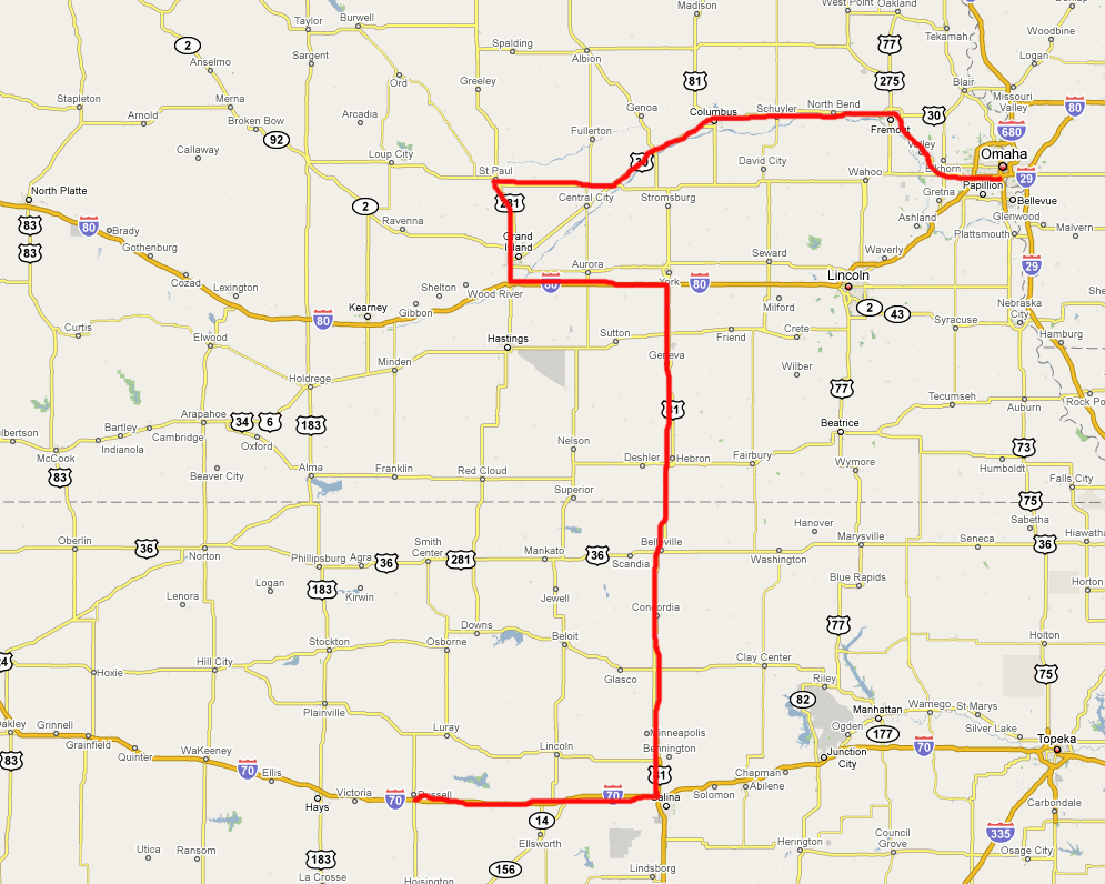
- Russell > (Kansas) > Grand Island (Nebraska) > St. Paul > Columbus > Omaha: a nice wall of clouds!
from Russell > (Kansas) > Grand Island (Nebraska) > St. Paul > Columbus > Omaha- Some images of this very special day...
- Animated Cloudwall
- SPC Convective Outlook for 24 may 2008
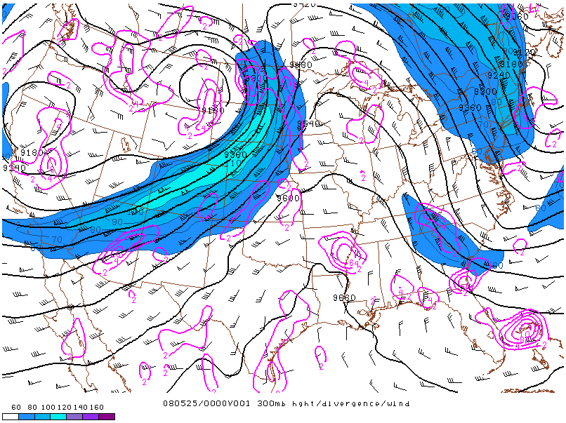
- Location of the jet on 25 may 2008 at 00:00 UTC
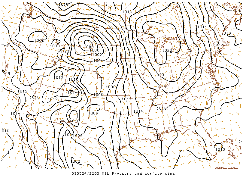
- MSL Pressure and Surface Wind on 24 may 2008 at 22:00 UTC
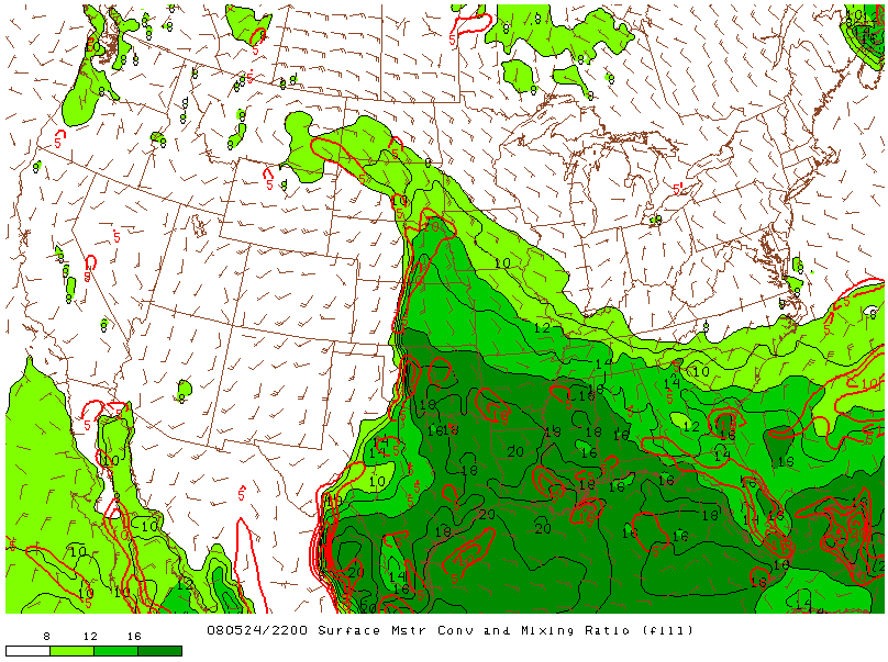
- Surface Moisture and Mixing Ratio on 24 may 2008 at 22:00 UTC
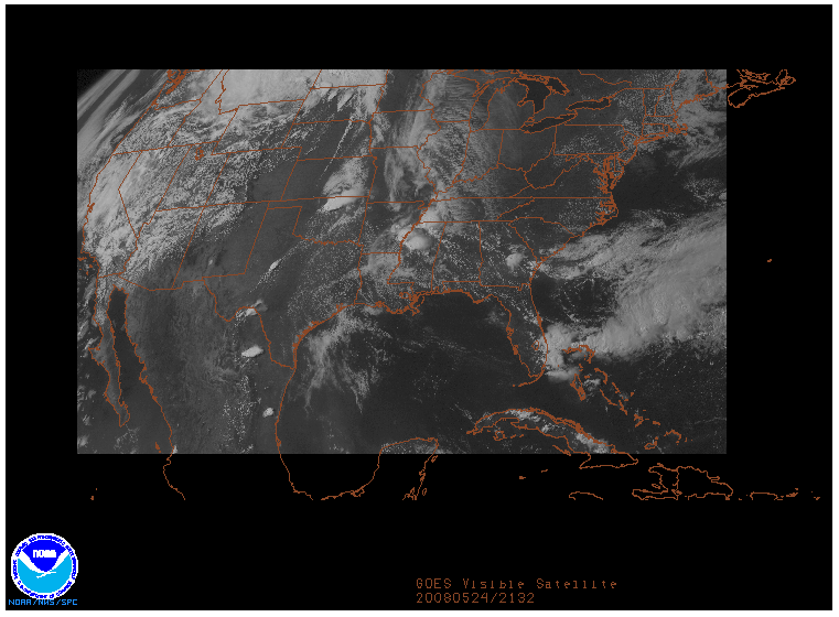
- GOES Visible image on 24 may 2008 at 21:32 UTC
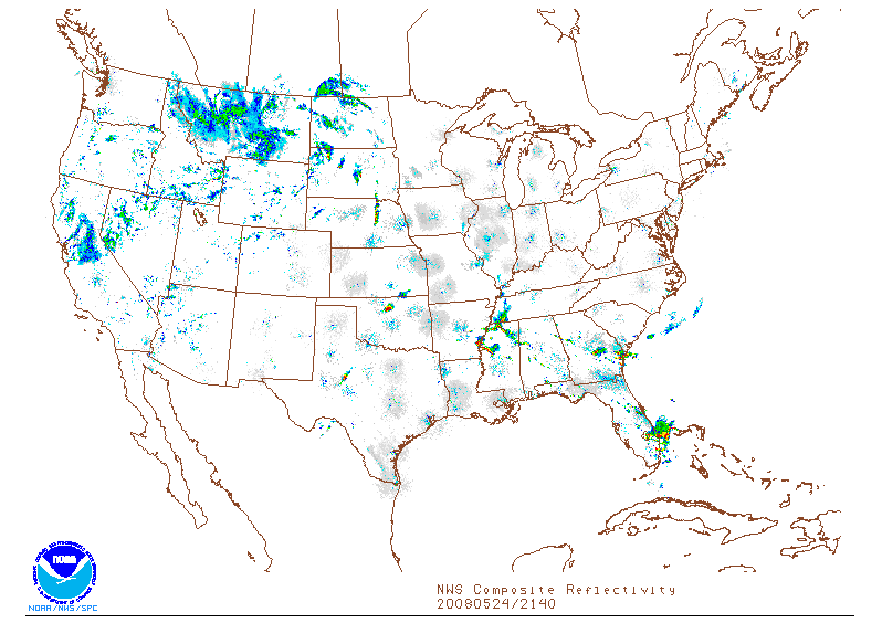
- NWS Composite Reflectivity on 24 may 2008 at 21:40 UTC
- SPC Storm Reports of 24 may 2008
- Archive of the Severe Thunderstorm Event: May 24, 2008
Russell > (Kansas) > Grand Island (Nebraska) > St. Paul > Columbus > Omaha: a nice wall of clouds!
Roy and I did a lot of study before going to the US. Not only reading the well-known literature but we did a lot of virtual storm chasing as well! In the early morning hours in the US (that is evening hours in Europe) we looked at the maps and tried to find out where to go. Hitting the road in our virtual chase-car while listening to the best music on the planet ;-) By lunchtime in the US (late evening hours in Europe) we performed an update of the maps and find out what has changed.Map: from Russell > (Kansas) > Grand Island (Nebraska) > St. Paul > Columbus > Omaha
The following is a virtual chasetour on 1 may 2008. We investigate the commonly used charts of SPC and NCAR and try to figure out where we have to go to look at severe weather and be on the safe side of it.
Location of the jet on 25 may 2008 at 00:00 UTC
MSL Pressure and Surface Wind on 24 may 2008 at 22:00 UTC
Surface Moisture and Mixing Ratio on 24 may 2008 at 22:00 UTC
GOES Visible image on 24 may 2008 at 21:32 UTC
NWS Composite Reflectivity on 24 may 2008 at 21:40 UTC
This site is under heavy construction... please have some patience... thank you!
| Stormchase USA 2008 - main page | Back home |
|
|