Casper ter Kuile
.... in preparation
This is the brand new personal website of ....Casper ter Kuile.... in preparation |
|
- Investigating the situation, where to go
- The charts and what they tell us
- The stormchase!
- Evaluation
- Reports
- Outlook for tomorrow (text)
- Outlook for tomorrow (charts)
Investigating the situation, where to go
Roy and I did a lot of study before going to the US. Not only reading the well-known literature but we did a lot of virtual storm chasing as well! In the early morning hours in the US (that is evening hours in Europe) we looked at the maps and tried to find out where to go. Hitting the road in our virtual chase-car while listening to the best music on the planet ;-) By lunchtime in the US (late evening hours in Europe) we performed an update of the maps and find out what has changed.The charts
The following is a virtual chasetour on 1 may 2008. We investigate the commonly used charts of SPC and NCAR and try to figure out where we have to go to look at severe weather and be on the safe side of it.
The stormchase!
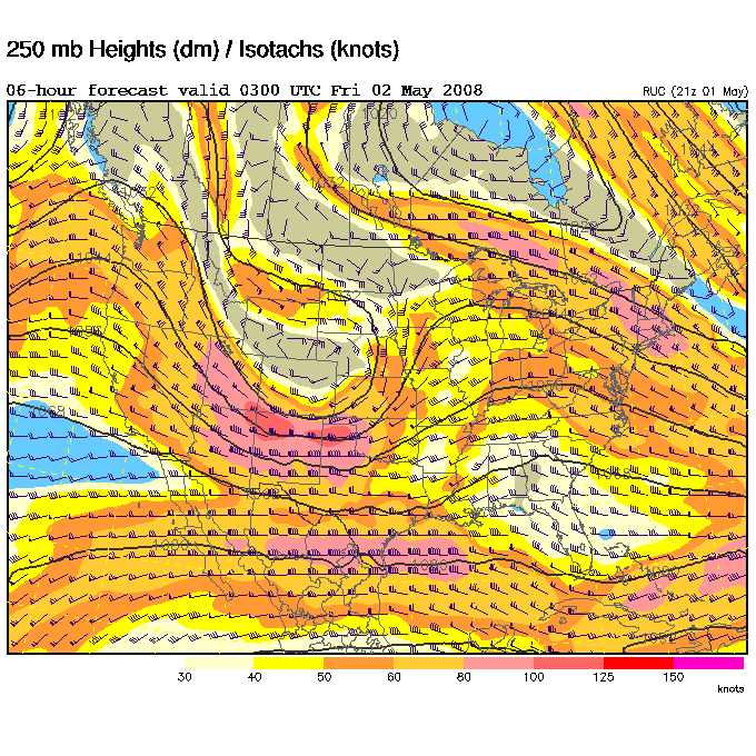
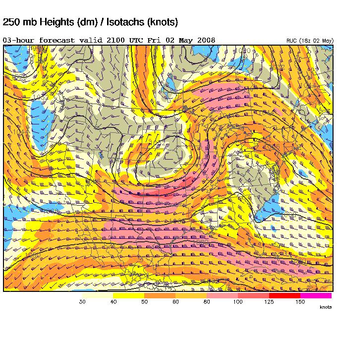
- Upper-Air 250mb chart: the location of the jet. Keep an eye of the south-east sector of it.
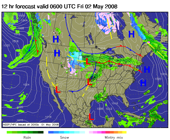
- Forecast fronts chart: this one provides us with the location of the low and associated warm and cold fronts. The amount of precipitation is indicated too. Compare this chart with the windspeed chart. Compare the location of the two low's with the jet.
- Windspeed Dewpoint & MSLP: where is that low? Find those southerly, or better yet south-easterly winds. This brings the moisture in.
- Temperature: should go high of course. But this parameter seems to be of lesser value compared to others.
- Dewpoint: 60° Fahrenheit or higher should be excellent. Please note the dryline in the west.
- Theta-E: the yellow or light green colored area's should be favourable.
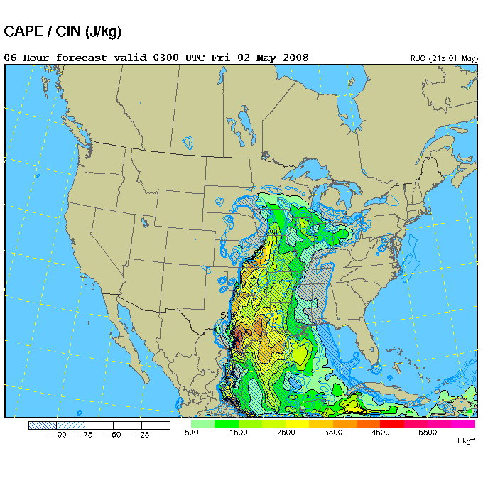
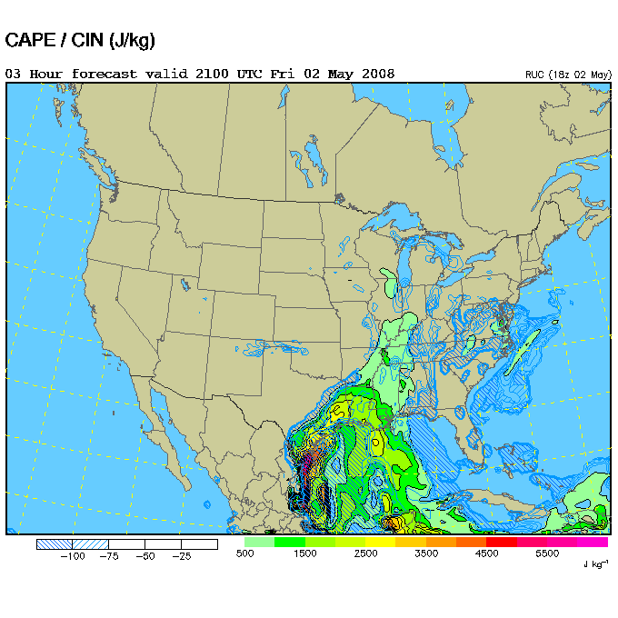
- CAPE/CIN: should be high but not capped. In this situation eastern Kansas seems to be best.
- Moisture/LI: should be negative. In this situation an area from northern Texas, over Oklahome until south-eastern Kansas should be good.
- Helicity & CAPE: hmmm... how about this one?
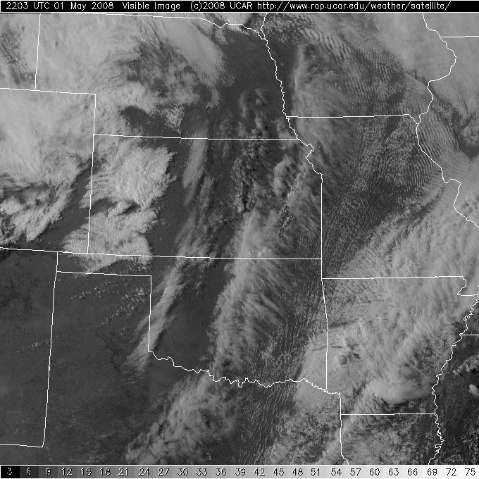
- Satellite - GOES - VIS: nothing happening at this moment. 22 UT equals 15 local time which is Central Standard Time (CST).
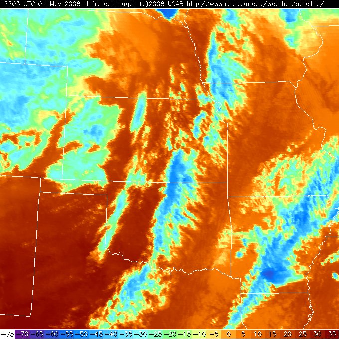
- Satellite - GOES - IR: this one is handy. What goes up gets colder and... darker blue! So find the dark blue spots on the IR.
Here we will present what happened during our chase. Where did we actually go and what did we see? You may expect some photo's here. And of cource we will let you know everything special we came across, please stay tuned for more! And finally... we evaluate if and, most important, why the storms did not materilse at the spot we choose. But that's the topic of the next chapter!Evaluation
After ending the chase, back in our hotel, we switch on the laptop and evaluate what actually happened that chaseday. Using the archive at the SPC it all becomes clear and we keep on learning which secrets are hiding in the US atmosphere.Reports
Oh yes... for those of you who worry on those two Dutch guys chasing after dangerous US severe storms... OK: we know we are just beginners. And knowing that we studied a lot. And promise you keeping away from those dangerous storms. So no "core-punching" for the Dutch but keeping at the save, southern, side of the storm.
And while beiing in another country has the advantage to learn the people and all the specials which makes the US as it is now. We hope to meet a couple of you while on the road. We will be driving around in a Pontiac G6. Like to contact us? E-mail: "stormchaser<at>casperterkuile.nl"
Final but very interesting after a long and hopefully stormy chaseday is... what's next in the US severe-weatherstore for us? Want to know? The next chapter tell's it all!
Outlook - text
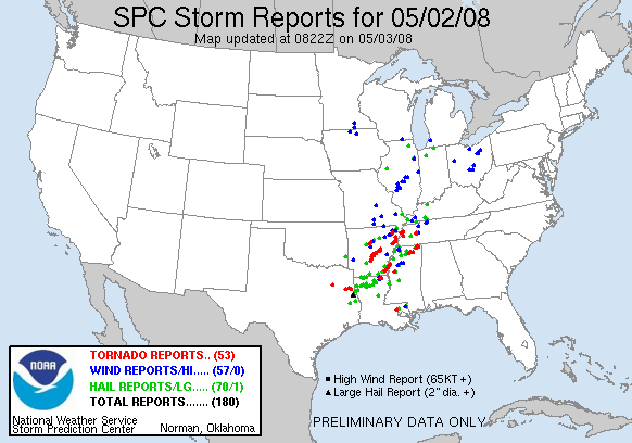
- The reports the day after: here we note a lot of severe weather has emerged, especially over Arkansas and across the border with Mississippi.
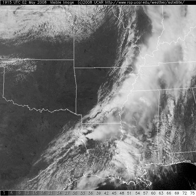
- Satellite - GOES - VIS: Here the severe weather is just over the Arkansas / Mississippi area.
- Satellite - GOES - IR: and the corresponding IR-image.
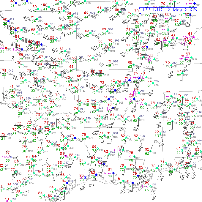
- Surface: this map represents the actual measurements.
- The location of the jet at the time of the severe weather. Note the severe weather occurred at the south-east area of the jet.
- Windspeed: note the southerly winds.
- Temperature: .
- Dewpoint: high over the mississippi river area.
- Theta-E: .
- CAPE/CIN: not very high values here but uncapped.
- Moisture-LI: .
- Helicity: nice values across parts of Tennessee.
Here we will present an outlook for tomorrow in case we will hit the road for the real stuff. The overview charts of the SPC, and in more detail the convective day 1 outlook, gives us some stuff to dream about...Outlook - charts
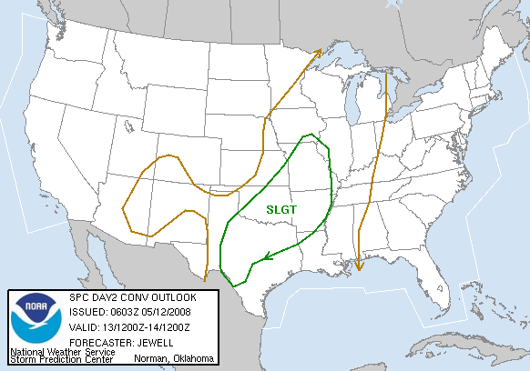
- The Day 1 Convective Outlook (SPC). Stormchasers are highly interested in the SLGT, MDT and HIGH area's.
- The location of the jet (NCAR - ETA). The jet is the steering system and controls the direction the low's are moving in (and high's which we are not interested in...)
| Stormchase USA 2008 - main page | Back home |
|
|